Grand Avenue Hazardous Door Zone Bike Lanes Video(s)

I’m posting two videos traveling from Mission Blvd to Lamont St. going Eastbound. One is filmed on a bicycle (with the camera mounted right of center) and the other from a motor vehicle with a dash cam mounted in the center just under the rearview mirror.

It is important for those not familiar with the rules of the road pertaining to bicyclists to watch both videos in their entirety and understand the concepts layed out in the video before commenting. Both CVC 21202 (far to right) and CVC21208 (bike lane) laws are covered.


On this portion of the road, the City of San Diego recently added more hazardous door zone bike lanes. These encourge bicycle riders to ride in the door zone, pass from the right, proceed to the right of right turning traffic at intersections and decrease visibility which increases the risk of right hooks, left corsses, and sideawipe crashes. While these bike lanes do have a “buffer” they still are not safe to use and in fact in the first video, where I’m riding a road bike, an MTS bus refuses to pass me when using the door zone bike lane presumably because the operator understood it wasn’t safe to pass me while using the hazardous door zone bike lane. This is clear evidence there is not ample space to fit a bike lane independent of all the other hazards the city presents bicyclists with by encouraging them to ride there.

The city’s installation of this garbage is pure neglegence and violates engineering ethics. This is personal opinion but this opinion heavily leans towards hard objective facts. The city strives to increase bicycling use through the idea that establishing a special space for bicycle riders to use (and thus be “out of the way” of motor vehicles) however this further increases the misunderstandings of where and when bicyclists can operate legally (which is every road in the city except most freeways and toll bridges) on the roadway and endangers novices by having them believe these neglegent hazardous spaces are the best places for them to ride. Cycling education and operating as a driver of a vehicle allows bicycle riders to operate in a manor that is signifacntly safer than how the city expects with bicycle lane use, especiually when they’re installed in the door zone. Competent law enforcement, which this city seems to lack also would help, and I’m talking to you SDPD officer who rolled a stop sign the other day when myself and other traffic on the road had the right of way. Stop signs are for you too!

The Grand Avenue door zone bikes lanes, as are all the city’s door zone bike lanes (and many of the non DZBLs) are not safe to use. The city if they had any sense would remove them immediately before they get someone killed following them, but it’s doubtful that’ll happen. Furthermore the city’s endorsement of edge riding through the use of bike lanes increases harassment of bicyclcists who are operating both safe and legallt in the roadway.

Green means “go”

Bicyclists using this “protected” bike “lane” are safe at intersections because there are two different phases of traffic lights- one for motor traffic, and the other for bicycle traffic. As long as all users follow the signals, as is done in magical Europe, everybody will be okay.

Just have a look.


Bikes May (Kind of) Use Full Lane

The town of Mammoth Lakes, in the beautiful Eastern Sierra region of California has installed Bikes May Use Full Lane signage on Old Mammoth Road every few hundred feet. Old Mammoth Road is one of the “main drags” which runs from Main Street which is CA-203 (where CalTrans “converted” the conflict-laden shoulder into a bike lane) to the lakes behind the ski area. It’s an area of heavy thru traffic and also has numerous commercial areas with driveways, alleyways, and intersections.

Riding to the right edge is not “practicable” on this stretch of road, there are too many driveways (drive outs, right hooks), intersections (right hooks, left crosses) and turning traffic using the center lane which could create moving blind spots if a bicyclist rides to the right of a passing motor vehicle. This stretch of of road also includes bus stops for the town’s public transportation system.

Many motorists, law enforcement officers, and unfortunately some bicyclists might look at this lane and the photo and assume there is enough width for a bicyclist to ride towards the right and for a motor vehicle to pass them safely within the lane.

This position incorrect as this lane width is still considered to be “sub-standard” which allows bicyclists the full use of the travel lane regardless of whether they are traveling below the speed of normal traffic. Bicycling safety advocates call this a “non-sharable” lane. Certainly motorists may see a cyclist, slow down if needed, and move a bit to the left to give some space but a bicyclist cannot expect this to happen all the time nor can a bicyclist expect every overtaking vehicle to be a passenger car. This action probably cannot be taken without the overtaking vehicle being positioned partially in the center turn lane.

In addition a number of right hand turns are authorized on this road as there are numerous driveways and intersections. Mammoth Lakes receives a considerable amount of snow per year as well. In winter sight lines for drivers entering this road from driveways have limited sight distance due to the piles of snow placed in the space between the roadway and the sidewalk. Bicyclists can and do ride these roads in the winter regularly well lit and with studded tires. If a bicyclist rides out in the center or left of center in the lane they will be helping motorists see them a bit sooner. If they ride too far right they may not be seen. Motorists regularly “nudge” the front of their vehicles out into the travel lane to help them see better too. This could cause an unfortunate collision.

The reason I’ve spend so much time explaining all of this is Mammoth Lakes also installed shared-lane markings (Sharrows) but they installed them too far to the right. Unfortunately, like the hazardous door zone bike lanes in San Diego (and many other places) bicyclists are essentially being instructed to ride in an area that exposes them to the hazards mentioned above. Segregation advocates commonly criticize sharrows and the examples they give are typically in areas where they were not correctly installed. This in part is why sharrow treatment sometimes gets a bad reputation.

Furthermore, the town installed R117 Pass 3 FT Min signs down the street. This is the first instance I’ve seen these in the state.

Many cities, would try to squeeze a bike lane here despite the hazards stated above which is also inappropriate.

I should also add that when considering the width of the travel lane and of the roadway in general, the gutter pan itself should not count towards that width. Gutters are for drainage and in this town, even in the dead of winter, the snowbanks are often melting. Dirt and rocks picked up off the roadway when the roads were plowed also collect in the gutters making them unusable for most bicycle travel.

The town of Mammoth Lakes has the right idea here but needs to improve on their implementation. It could be worse however as they did paint bike lanes on similar roads in the town which have just as many potential conflicts as this one does.

Gemetric Design Cartoons

In the process to find out exactly what sort of mind altering substances some traffic engineers appear to be using that makes them think it’s okay to endanger bicyclists by placing them into hazardous door zone bike lanes (along with all the other edge hazards), I came across the city’s Street Manual.

Inside the manual, I found several plans and profiles for the variety of street layouts and combinations. Nearly every single one of them that included a bike lane had them in the door zone. This latest version was published in March of 2017.

The P&Ps below most closely represents the new configuration and geometry of Grand Avenue in Pacific Beach but without the commercial driveways and bus stops. I’ve taken the liberty of adding a few lines to indicate potential hazards a bicyclist using the bike lanes could encounter.

America’s Finest Bicycling Hazards

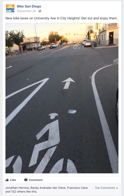
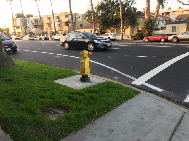
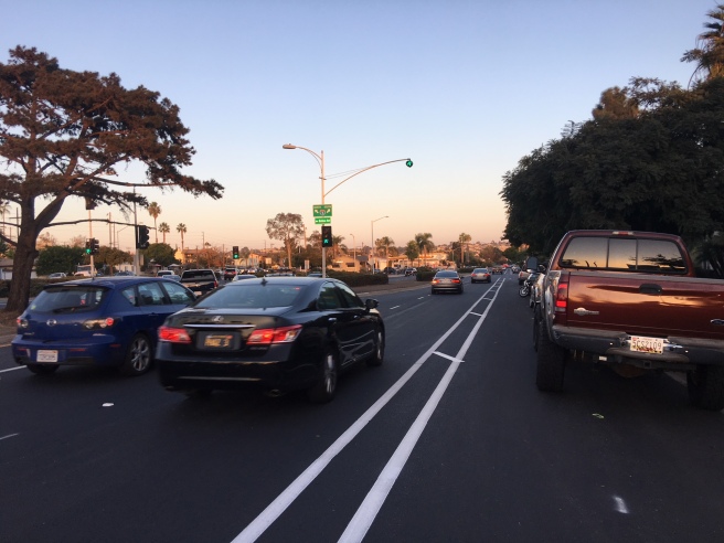
In the summer of 2015, the city under Mayor Kevin Faulkner , announced an ambitious scheme to repave or repair 1,000 miles of city streets within five years. The city government also launched a slick website where residents can track the progress of projects. In 2017, several streets in Pacific Beach including parts to two major east-west arterials, Balboa and Grand Avenue, received new pavement and new markings. A number of local streets, Lamont being one of them, also received a brand spankin’ new ribbon of asphalt. There seems to be a delay of a few weeks up to even over a month for a striping crew to return and paint the lane markings, turn pockets, and crosswalks. One of the things on my to-do list was to consider drafting up an email to the city requesting they look into adding shared-lane markings (i.e, Sharrows) and “Bikes May Use Full Lane” signs to both Balboa and Grand. Turns out I was too late. Over the weekend – or very late last week, a striping crew started painting hazardous door zone bike lanes (DZBLs) on Grand Avenue from Ingraham to Olney. To get an idea of what is where, see the map below. Click on each color for reference.

On these two roadways, a bicyclist wishing to travel straight will in most cases will be using the right hand most lane unless it is a right turn only lane, in which bicyclists are only allowed use them when turning right. The safest position to avoid the hazards of opening car doors, drive outs, right hooks, left crosses, and close in-lane passes is to control the lane. Both of these roads contain more driveways than can be counted, constant intersections, and permitted on-street parking vehicle storage, and to add to that – the width of the lanes are not even close to “sharable,” therefore CVC 21202 (the commonly misunderstood far to right law) does not apply. CVC 21208 (the mandatory bike lane law) obviously doesn’t apply on most of these roads either. Parts of Grand Avenue, which are outside the scope of the current resurfacing projects, already have hazardous door zone bike lanes.

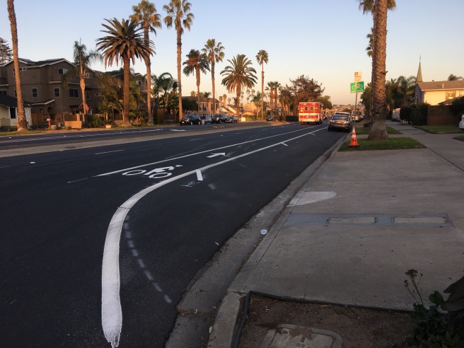
Oddly enough, the portion between Cass Street and Ingraham – just west of the brand new hazardous DZBLs, contain no bike lanes at all but have a shared-lane marking (sharrows) painted at the beginning of every major intersection. The lateral position of the sharrows, to the city’s credit, were placed quite well in the center of the lane away from the door zone. The only problem with the small section that received this treatment is the lack of BMUFL signs (optional anyways) and the markings are only placed at the beginning of each block after a major intersection which is over 500 feet! These intervals do not meet the California MUTCD’s requirements which require the intervals between markings be no more than 250 feet. Even if these sharrows were not present, a bicyclist is still allowed to control the full lane for his or her safety and visibility.

DZBLs also exist, but have been installed for some time now, between Mission and Cass (toward the ocean) and in the vicinity of Mission Bay High School (toward the I5 freeway).

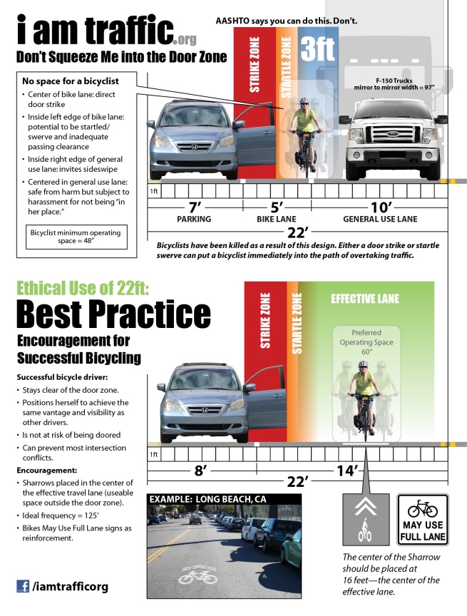
Two highly mandatory pieces of reading discussing the hazards of door zone bike lanes are Paul Schimek’s recent paper and Wayne Pien’s 2004   paper. For those who don’t want to spend so much time reading, the folks who run the I Am Traffic page (see links library) have a great scaled infographic. Surprisingly these hazards are approved to use by AASHTO and are used not just in San Diego but in other cities across the US.  BikeSD, one of the local advocacy groups even seems to be okay with them. Because hey, more bicyclists (no matter the increase in injuries or deaths) is good, right?

Here are some “before and afters” on Grand. Balboa itself doesn’t have any bicycle lanes or sharrows.

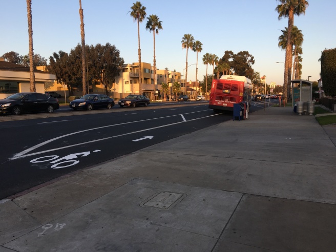
  • SE corner of Grand Ave and Ingraham St, looking NE, also a MTS bus stop. There is also a Wendy’s restaurant here with and driveway commonly used for both entry and exit to the parking lot and another driveway that’s specifically an exit for the drive-thru.

IMG_7571.JPG

  • Driveway exiting KFC restaurant (closest) and a residential driveway (farthest) leading to a multi-family housing unit.  Notice the odd “hash marks” these are usually used for “buffers” in bike lanes.

IMG_0261.JPG

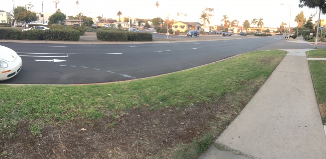
  • SW corner of Grand and Jewell, looking NW. Notice the bike lane drops but the fog line is painted with an odd curve and sloppily extends through the limit line.

IMG_4411.JPG

  • Other side of  above intersection, where the bike lane “starts” again, now looking East.

IMG_2771.JPG

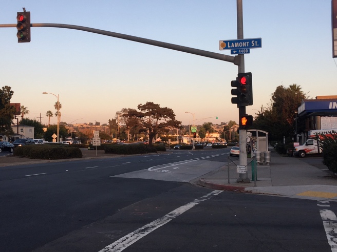
  • Intersection of Grand and Lamont, still looking East. Note at this corner there is a gas station which sees lots of vehicles entering and exiting Grand. Right turn traffic volume onto Lamont is high too.  The Google Streetview image was taken out in a different lane which makes comparing the two views somewhat confusing.

IMG_2356.JPG

  • The other side of the Grand and Lamont. Note the bus stop. It appears the slash marks indeed are to add a “buffer” to the bike lane.

IMG_0655.JPG

  • Still going east, and facing east on Grand, slightly passed the MTS bus stop. There is absolutely not enough space. The buffer is still in the “startle zone” at best, and at worst, it’s very much in the door zone. If a cyclist were riding in this bike lane, the black car would also be passing them with under three feet of clearance, which is supposed to be against the law. The city not only designed a hazardous door zone bike lane but is encouraging traffic movements in violation of a CVC law. Bicyclists do not have the minimum required operating space here either. Also note a few spots in front of the parked pickup, there is a motorcycle parked with its back wheel against the curb and the front wheel intruding into the bicycle lane. A Ford F-150, not including the mirrors is over six feet wide. A Harley Davidson Road Glide is a surprising 7.8′ long.

IMG_0657.JPG

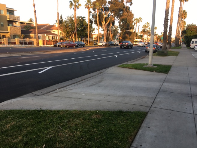
  • The last photo looking eastbound is a panorama just to show the bike lane dropping very early before the next intersection. The striping crew seems to be planning to place another odd curved fog line here as well.

IMG_0661.JPG

Bike lane or not, door zones are never safe places for a bicyclist to ride. Even if the faux buffers were installed to the right instead of the left to try to squeeze the bicyclist further left, they still run the risk of injury by being startled by an opening car door. There isn’t enough space in this right of way, period.

The city should take steps to tear out this garbage immediately and either return it to normal travel lanes with no treatment or follow the CA-MUTCD’s requirements for placing sharrows and/or BMUFL signs.

Bicyclists who are aware of the risks of riding in the door zone will probably choose to not use the bike lanes and will control the lane as normal. I, for one, will continue to do this. However, bicyclists who choose to do this will risk harassment from motorists (aka, why aren’t you in the bike lane?) and also risk a CVC 21208 (mandatory bike lane law) ticket even though such could be thrown out in court with the right expert witnesses.

Bicyclists who are not aware of the risks of the door zone in general will experience increased risk of being doored and all the other potential hazards associated with edge riding. Unfortunately, if a bicyclist is doored, chances are they will be severely injured or even killed. The incident will not be counted as a typical bicycle-motor vehicle crash either. Let’s also not forget about all the traffic entering and exiting the various driveways that serve both residential and commercial properties and the motorists scouting the street looking for parallel parking spaces.

Edit: I’ve added the infographic from I Am Traffic since the link above doesn’t direct properly (thanks Google)